Monday, 23 August 2021

Rathlin Island Walks

Prospect of Rathlin's Harbour from the Manor House (Image: Timothy Ferres, 2021)

I last stayed on Rathlin Island four years ago, in August, 2017; its allure is quite irresistible to me.

The island's population has doubled in my lifetime, and now totals about 170.

Not so long ago the little primary school had eight pupils; whereas today that figure has increased to almost twenty.

My journey began at Ballycastle, County Antrim, where I embarked upon the ten o'clock vehicle ferry for the 45-minute sailing to Church Bay, Rathlin's nucleus.

I should explain that there are two ferries: a fast one, which takes merely 15 or 20 minutes; and a slower one, which can take vehicles.

I stayed at the manor house guest-house, ancestral home of the GAGES, landlords and proprietors of Rathlin Island since the mid-18th century.

I think they purchased the island from the Earl of Antrim for the princely sum of £1,750, the equivalent of about £400,000 today. Quite a bargain!

During my stay on the island I encountered quite a few interesting people.

Since I've already wrote a bit about the MANOR HOUSE GUEST-HOUSE in 2017, I propose to recount one or two of my walks.

On Tuesday, August 17th, I walked eleven and a half miles, from the manor house in a westerly direction to the Kinramer North and Kebble South trails.

I began my walks from the manor house, which is directly opposite the main harbour.

The weather was inclement during most of my stay, so I wore my 1990s pair of Raichle hiking boots, with waterproof over-trousers and anorak; and a little backpack with binoculars, something to drink, directions, etc.

By the way, the old hiking boots gave me trouble: one of my ankles was sore, and the boots were leaking (subsequently I purchased a new pair of Salomon Quest Four hiking-boots). 

On Wednesday, August 18th, I decided to ramble from my accommodation at the manor house towards the East Lighthouse and Ballyconaghan.

Former Pigeon-House beside the Manor House
(Image: Timothy Ferres, 2021)

As I passed the former coach-yard, attached to the manor house, I peered in and under the arch, to the left, the former pigeon-house could be seen.

What is now the island's health centre, at the other side of the arch, was once a livestock barn.

Just past the health centre there's a former coal-yard, which also has an arch and matching doors; and a distinctive carved stone erected by the Rev Robert Gage in 1816.

I walked further along Church Bay and turned left at McCuaig's Bar, up a short, steep road to a junction, where I turned right.

This used to be a busy thoroughfare on the island, with a grocer's shop, the rectory, the police station, a public house, and the smithy.

The former police station, I suspect, is on private land, so I didn't venture towards it; though I believe that it was originally called Ballynoe House, and was the residence of the MacDonnells, Earls of Antrim, who sold Rathlin to the Gages.

The Glebe House, Rathlin Island (Image: Timothy Ferres, 2021)

The Glebe House, as it's now known, was once the rectory.

The last rector to reside there, I think, was the Rev George James Boucher, Rector of St Thomas's from 1950-56.

The Gages have been using it as their island residence since about 1975.

The former Smithy, Rathlin Island (Image: Timothy Ferres, 2021)

A bit further along the road I passed the smithy or forge, where the resident blacksmith made and repaired cartwheels, nails, and shod horses.

After ten or fifteen minutes I came to a clachan or cluster of three houses up a short lane.

These dwellings belonged to the McQuilkins and the Cecils. 

The McQuilkin and Cecil Clachan (Image: Timothy Ferres, 2021)

They're all derelict and quite dilapidated, though not beyond restoration; the first house on the left probably being the most recent building. 

HAVING had a brief look through the closed gates of the East Lighthouse, I turned back along the track, and made my way to the National Trust trail.

Eventually I reached another clachan of four cottages at Crocknanagh, where more McQuilkins and Currys lived.

The Crocknanagh Clachan (Image: Timothy Ferres, 2021)

I'm told that the McQuilkins had a pretty little walled garden under the tree, where colourful shrubs thrived.

I've already written about the coastguard hut at the top of Cantruan hill and, on this occasion, I decided to omit it from my walk; so I walked back to the tarmac road, down a gently sloping incline, and walked past the Catholic church of the Immaculate Conception, built in 1864 to replace an older church.

Part of the interior wall of the previous church remains behind the present one; and a series of steps lead up to the relatively modern 1980s parochial house.

No parish priests have lived here permanently since 1999.

The former Pound, Rathlin Island (Image: Timothy Ferres, 2021)

Directly opposite the church is the children's playground, originally a small field where stray animals were impounded by the landlords, the Gages.

Anybody who owned one of these stray animals was compelled to pay a fee for its release; a considerable deterrent I imagine!

The Parochial Hall, Rathlin Island (Image: Timothy Ferres, 2021)

Beside the playground is the parochial hall, built about a century ago; and further along is the primary school, which had a mere eight pupils five or six years ago.

Today numbers are increasing, and I'm told that there are up to twenty children.

When they reach the age of eleven, they need to attend classes on the mainland. 

Former Shop opposite the School (Image: Timothy Ferres, 2021)

On the other side of the road is a tiny one-storey building with two large windows and a door.

It was closed when I saw it, though I peered inside and it seems to be an artist's studio of some sort.

It was originally a little general merchant's shop.

Islanders were generally self-sufficient in fruit and vegetables, eggs, and dairy produce.

Certainly there's a lot to explore on Rathlin.

The Cooraghy Bay pier could be developed as an industrial tourist attraction, for instance.

This pier was constructed in order to convey building materials for the new West Lighthouse about 1910.

Abandoned Pier at Cooraghy Bay (Image: Timothy Ferres, 2021)

From the top of the cliff, a series of steep concrete steps, with a single hand-rail, lead down towards the pier, though they terminate suddenly not far down the cliff, making it hazardous to attempt the descent today.

An ingenious method of hauling the building materials up was conceived with, quite literally, horse-power, winches, a derrick, and rail lines.

I purchased a very good guide called Eight Walks On Rathlin Island, written by Nicky Sebastian in 2018.

I bought it in the manor house, and heartily recommend it.

Sunday, 1 August 2021

Hillsborough Fort Guard Revival

One of my earliest articles on this blog was about the HILL family, Earls of Hillsborough and Marquesses of Downshire.

I have also written quite a lot about the splendid village of HILLSBOROUGH, Royal Hillsborough as it will formally be known later in the year.

My invitation stated Robes, Uniforms, Lounge Suit; Medals, Decorations optional; so I wore a lounge suit.

I thought, a week ago, that I'd need to wear a hat to protect my head from the blazing sun; this requirement was, however, unnecessary. It was mainly overcast, with occasional drizzle.

If anything, I omitted to bring an umbrella.

IN 1660, CHARLES II granted a Royal Charter to HILLSBOROUGH FORT, County Down.

Coat-of-arms of Wills, 1st Marquess of Downshire,
created Baron Harwich in 1756

This fort was erected by the Hill family, and its purpose was to maintain a military presence in the district.

Moreover, this Royal Charter also bestowed the title of Hereditary Constable of Hillsborough Fort on Colonel Arthur Hill, his successors, and assigns.

Furthermore, Colonel Hill was entitled to raise and maintain a Guard of twenty troops to occupy the fort.

The duty of these Fort Warders was to guard the military garrison between Dublin and Carrickfergus.

The Fort Guard remained at full strength until the early 20th century, when government payments ended.

In 1954, the last surviving Warder, a First World War veteran, Jack Green, died and, in order to keep the tradition alive, the 7th Marquess of Downshire decided to retain the post of Fort Bugler.

This post remains to this day, and Fort Bugler Andrew Carlisle has held it since 2006.

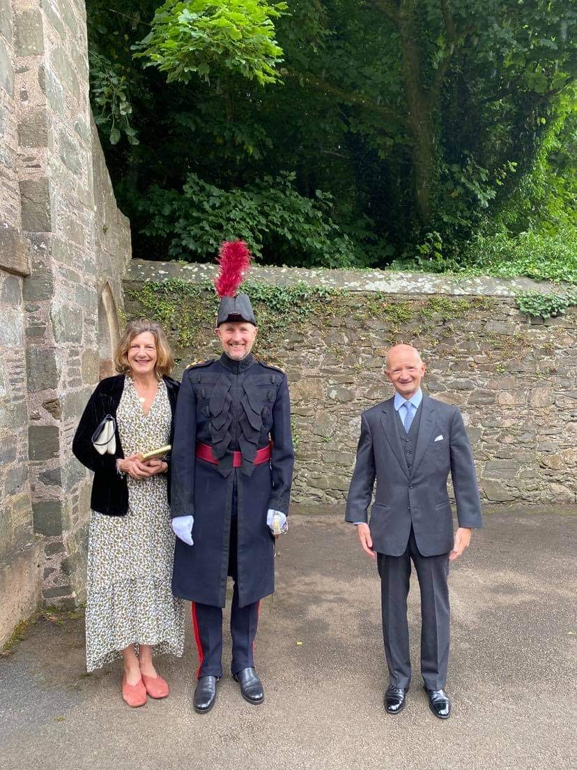
Sergeant Bugler Andrew Carlisle & Mark Thompson
(Image: Hilary Thompson)

Recently it was felt, quite appropriately to my mind, that this historic tradition should be revived under the guidance of the 9th and present Marquess of Downshire.

The local historical and cultural society, the Hillsborough Old Guard, provided six period uniforms replicated from the original pattern, and has also provided assistance in the recruitment of new Fort Warders.

I was invited to the investiture ceremony and morning review of the Hillsborough Fort Guard on Saturday morning, the 31st July, 2021.

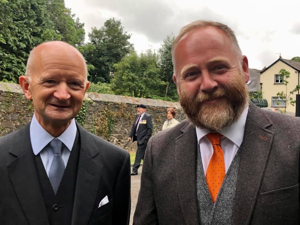
Mark Thompson and Self (Image: Hilary Thompson)

I arrived perhaps ten minutes or so before the ceremony began, and was delighted to encounter my friends Stanley Gamble and Mark and Hilary Thompson.

The Most Hon the Marquess and Marchioness of Downshire and Self
(Image: Rev Dr Stanley Gamble CF)

Stanley introduced me to Lord and Lady Downshire, which afforded me the opportunity to present Lord Downshire with a small token of my esteem on what was a historic event.

The Rev Dr Stanley Gamble, CF, with Mark & Hilary Thompson (Image: Timothy Ferres, 2021)

At ten o'clock, there was a bugle fanfare, and the hereditary Constable, Colonel the Most Hon the Marquess of Downshire, arrived, accompanied by the Marchioness of Downshire.

We, the spectators, all stood on the front lawn of the Fort.

Lord and Lady Downshire in the Parade (Image: Alan Ewart, 2021)

Following a general salute, we were addressed by Lord Downshire; the Royal Charter of 1660 was proclaimed; the Chaplain, the Rev Dr Stanley Gamble, CF, led prayers and blessing.

This ceremony was followed by the investiture and the signing of warrants by the new Fort Warders.

The Mayor & Mayoress of Lisburn and Castlereagh with Self
(Image: Rev Dr Stanley Gamble CF, 2021)

Lord Downshire gave a closing address, with a response by the Right Worshipful the Mayor, Alderman Stephen Martin.

Hillsborough Fort Guard in front of the Fort (Image: Timothy Ferres, 2021)

The Fort Guard was inspected, there were closing prayers and, following the National Anthem, the parade marched off.

The Parade Appointments were as follows:-
  • Reviewing Officer, Colonel the Most Hon the Marquess of Downshire
  • Parade Chaplain, the Rev Dr Stanley Gamble CF
  • Parade Sergeant-Major, HFG Sergeant-Major P F Shields VR
  • Parade Bugler, HFG Sergeant Andrew Carlisle
  • Parade Drummer, Colour Sergeant G Chambers, Irish Guards
  • Parade Fifer, Colour Sergeant P Carson, Irish Guards
  • Sergeant-at-Arms, Mr Colin Ward
Guard members on parade:-
  • HFG Corporal Simon Walker
  • HFG Corporal Robert Finn
  • HFG Warder Alan Finn
  • HFG Warder Charles Diett
  • HFG Warder Jackie McQuillan

The Irish Guard musicians were in attendance by kind permission of Lieutenant-Colonel R P Money, Commanding Officer, 1st Battalion, Irish Guards.

The Most Hon the Marquess of Downshire, Hereditary Constable,
Hillsborough Fort Guard (Image: Timothy Ferres, 2021)

The end of the ceremony gave us an opportunity to meet others, including a former fellow Young Unionist, the Right Hon Sir Jeffrey Donaldson MP.

I should explain that four decades ago Jeffrey and I belonged to the Young Unionists, a branch of the Ulster Unionist Party. 

We used to meet at the party GHQ in Glengall Street, behind the Grand Opera House.

Jeffrey did remember me, and we reminisced a bit about the days of the Rt Hon Enoch Powell MBE MP, who represented South Down in parliament.

I left the UUP very many years ago, and indeed politics.

It was a great honour to be present at Hillsborough Fort yesterday, and I'd only wish to express my gratitude to everybody who made the occasion possible and so memorable.

Saturday, 17 July 2021

1953 Victory Re-Union


I don't suppose any readers attended the 1953 Coronation Victory Anniversary Re-Union at the Ulster Hall, Belfast, on Friday, May 8th, 1953?

And before you ask, young Timothy William didn't appear on "the scene" until 1959!

Click to Enlarge

I have unearthed an old programme of the occasion.

Sonya Lady Enniskillen was President of the Re-Union committee; while the main guest stars were Cheerful Charlie Chester and the Five Smith Brothers...

Click to Enlarge
The list of subscriptions makes for particularly fascinating perusal: Lady Enniskillen donated a fiver, bearing in mind that £5 was equivalent to about £100 in today's money.

A certain Brian Faulkner donated ten shillings (£10 today).

Recognize any other names?


I wonder if the Ulster Hall or Belfast City Council would be interested in the old programme?

First published in September, 2010.

Friday, 16 July 2021

Prince Edward in NI

THE EARL OF WESSEX, Royal Colonel, 2nd Battalion, The Rifles, has arrived in Northern Ireland on the occasion of a visit to the regiment.

His Royal Highness was greeted by the Lord-Lieutenant of Belfast, Mrs Fionnuala Jay-O'Boyle CBE.

Prince Edward travelled to Thiepval Barracks, Lisburn, County Antrim, where he was received by the Lord-Lieutenant of County Antrim, Mr David McCorkell.

Friday, 2 July 2021

Princess Anne in NI

The Princess Royal has today paid a visit to County Antrim.

Her Royal Highness was received by the Lord-Lieutenant of County Antrim, Mr David McCorkell, at Antrim Castle Gardens, where HRH presented the Friends of the Castle Garden with The Queen's Award for Voluntary Service.


Her Royal Highness met Council borough staff who have been recognised for their exceptional work during the pandemic, and learnt more about various council projects to mark the Centenary of Northern Ireland.

Monday, 28 June 2021

The Argory: Coach Yard

Prospect of the Coach Yard from the Porte-Cochère

Yesterday (Sunday, 27th June, 2021) I spent a lovely day at The Argory in County Armagh.

It's only just in County Armagh, because the River Blackwater, which naturally divides counties Armagh and Tyrone, runs past it.

I was waiting patiently at the main entrance when the gates were opened at 11am.

Since we are all gradually recovering from the ghastly pandemic, The Argory is slowly returning to a degree of normality: the tearoom serves beverages, scones, cakes, and snacks; the shop seems to have closed down indefinitely; and house tours are unguided, and only on the ground floor.

The beautiful grounds are fully open, however; so I took the opportunity to walk round the perimeter of the estate, along the river bank, to Bond's Bridge.

At the coach yard I sat outside in the sunshine, below the porte-cochère, and enjoyed a salted caramel caffè latte.

The National Trust heritage records apprise us that the stable yard or coach yard lies immediately east of the domestic yard.

"Brownlees’ drawing is a proposal and includes a large complex of additional spaces to the east, or behind, what remains today, his main block of stable and double coach house."

"This building now sports an iron and glass port-cochère dating probably from the 1880s."

"The difference now is that the building that connects the stable to the main gate and, rather than storage, it is now a harness room."

"The south side of the Coach Yard was to have been open in both Williamson's and Brownlees’ designs."

"The ordnance survey maps show that it was not until the late 19th century that the present coach house and open sheds were constructed, perhaps at the same time as the port-cochère as part of a general improvement of the yard."

Of interest today are "drawings and instructions left on the wall by the American army billeted at The Argory during the early 1940s."

"The west end of the Coach Yard is now occupied by the Dairy; this must have been built as part of the late-19th century improvement campaign."

"It is possible that the function of dairy was carried out in the fold yard until this time; once it was shifted the loose boxes would have replaced it."

"Creating the dairy meant that the Coach Yard and the Flagged Yard were separated by a substantial building rather than a wall as before."

Saturday, 26 June 2021

Island Taggart

I FIRST PUBLISHED THIS ARTICLE IN 2010 IN COLLABORATION WITH CRAIG McCOY, A STRANGFORD LOUGH WARDEN AT THE TIME.

INTRODUCTION

ISLAND TAGGART, Strangford Lough, County Down, is a property of the National Trust.

It lies between Ringdufferin, directly to its north, and Killyleagh, the nearest village, to the south.

The island is situated at the townlands of Rathcunningham and Moymore.

Taggart is one mile long and a quarter of a mile wide at its widest point, a total area of about 85 acres, acquired in 1984 from Patrick and Kathleen Mackie.

Click to Enlarge

Its length and the height of its two drumlins make it particularly attractive in the southern half of Strangford Lough.

From the higher points there is a fine prospect of varying habitats: from the eastern side, the main body of the lough with its marine life, sea-birds and the landscape of the Ards Peninsula; while, to the west, the sheltered mud-flats and salt-marshes with their population of waders and waterfowl.

WILDLIFE

The range of habitat types and abundant cover provided by pasture-land, scrub, hedgerows, marsh, foreshore and woodland ensure that the island is exceptionally attractive to wildlife.

A wide variety of butterflies and insects are to be found on the island; and the areas of scrub, with hawthorn, elderberry and brambles, provide excellent feeding for small birds on both the insect life and the fruit.

It is an important wintering ground for chaffinches, linnets, skylarks, stonechats and reed buntings.

There have been two large badger sets occupied on the island; and there is evidence of foxes.

Otters frequent the northern tip.

Porpoises can sometimes be seen feeding close to its eastern shore.

WILDFOWL

The mudflats to the west of the island provide good feeding for curlew, redshank, oystercatcher, knot, dunlin and turnstone; greenshank and ringed plovers have also been seen.

Terns and black-headed gulls are almost always to be seen around the shore; and, in the winter, there are abundant razorbills, guillemots, cormorants and, occasionally, great northern divers.


NOTABLE FEATURES

On the southern tip of the island there is an open circular stone kiln thought to have been used for burning kelp to produce potash for agricultural purposes.

Close to the north-eastern bay is a second, larger kiln which is very well preserved with a stone corbelled roof.

At least two wells on the island are built of stone with interesting features which make them worthy of restoration.

At the extreme north-eastern tip of the island there are two "fairy thorns" enclosed in a low ring of stones.

In the past, Island Taggart was intensively farmed, though vegetation has now become more varied and there exists an important field system south of the farmstead with a valuable copse of oak, beech, ash, Scots pine, sycamore, elm and alder trees.

FARM BUILDINGS

The principal farmstead with its stone-built, slate-roofed, single-storey derelict farmhouse with its farm buildings (a store; cow byre; calf-boxes; and hay-store) are all stone-built, partly slate.

An old well is located just to the side of the sunken lane which runs from the east shore up to the farm.

There is an old orchard behind the farmhouse.

Island Taggart is one of the largest islands on Strangford Lough.

Visitors are welcome.

There are good anchorages off the eastern shore and at the north-west corner of the island, depending on the weather, although care on a falling tide is advisable.

Old farm buildings give a good indication of life on the island and, indeed, it was used by Little Bird Films to make December Bride, a story by Sam Hanna Bell about County Down folk at the turn of the 19th century.

Thick hedges full of bird life, relatively unspoiled meadows full of wild flowers, and small marshes bright with Yellow Flag iris and orchids make this a lovely island to visit, whilst in high summer it is full of butterflies including large numbers of Common Blues and Small Coppers.

Simmy Island (Lady Hastings) lies at Island Taggart's north-western tip; while the Dunnyneill Islands are to the south-east.

Dodd's Island, a little one-acre islet, lies between Island Taggart and the mainland.

One small, ruinous cottage is at the northern tip of the island; two other cottages, which are within fifty yards of each other, lie at the eastern side of the island about two-thirds of the way up from the southern tip; and the main farm sits at the top of the hill in the middle of the island.

The main farm, with farm-house, outbuildings directly opposite, farm-yard, walls and pillars with "bap" toppings, an old orchard, a stone well, privy and other features, is substantial enough and could conceivably be restored at some future date.

A lane ran from this farmstead down the hill, past the well (marked on the map), to the eastern shore and still exists today.

Two further wells served the cottages to the north of the island.

POPULATION

There is a comment on the island in 1821:
Taggart Isle is attached to the parish of Killyleagh and contains 3 houses and 23 inhabitants.
This figure seems to have been at the time when the number of islanders was at its peak.

The island was attached to the Parish of Killyleagh in the barony of Dufferin.

The owners were Lord Dufferin and Claneboye and Catherine A Hamilton.

    • 1841: 9 males, 6 females, 2 houses occupied
    • 1851: 4 males, 2 females, 1 house occupied
    • 1861: 3 males, 2 females, 1 house occupied
    • 1871: 3 males, 3 females, 1 house occupied
    • 1881: 3 males, 4 females, 1 house occupied
    • 1891: 3 males, 6 females, 1 house occupied
    • 1901: 2 males, 2 females, 1 house occupied
    • 1911: 2 males, 1 female, 1 house occupied
    • 1926: 1 male, 1 female, 1 house occupied

      The census and will records of Island Taggart record several families, all of whom were Presbyterian farmers:

        • Samuel Bishop, son of James and Margaret, died on the 7th August, 1855 aged 67
        • Grace Bishop, possibly Samuel's sister or wife, died on the 12th March, 1877
        • Thomas Morrow died on the 15th July, 1898 and probate was granted to his widow, Bridgetta. He left £440 7s 6d (£43,000 in today's money)
        • The 1901 Census recorded Bridgetta Morrow, 67, Head of Family; Samuel Morrow, 34, son; May Morrow, 25, daughter; and Samuel McDonald, 23, servant
        • the 1911 Census recorded Bridgetta Morrow, 80; Samuel Morrow, 45; and a new servant, John Fitzsimmons, aged 35
          In the spring of 1966, East Down Yacht Club purchased lands from James (Jimmy) Nelson's father and thereafter established the sailing club which hadn't existed prior to this.

          Mr David (Davey) Calvert was the last resident on Island Taggart, and he left the island in 1967.

          First published in December, 2010.