 I rose from my slumber fifteen minutes earlier than usual this morning, prepared a packed-lunch of ham-and-cheese granary rolls and left home at nine o'clock in a southerly direction, the first meeting-point being Mount Stewart.
We assembled at the car-park and shared lifts onwards to Ballyquintin Point, at the very tip of the Ards Peninsula in County Down. I'd never been there before. It's not really that far beyond Portaferry. Ballyquintin is flat, windswept farmland, largely unspoilt. The National Trust is using traditional practices to re-grow indigenous hedges and fields which are partly meadows. It's worth a visit; there aren't any
 facilities except a small car-park.
Today we were clearing away grass and weeds from a plantation of saplings; and in the afternoon we cleared a large field of ragwort. I've never seen so many ladybirds in one place before. We lunched at a second world war look-out post. We had quite a good turn-out today: there were about ten of us altogether. We spotted a kestrel hovering above a field.
Here is the National Trust description of Ballyquintin:-
Ballyquintin Point
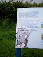
Ballyquintin is a 64 acre farm set amid rolling drumlin countryside at the southern tip of the Ards Peninsula, beside the Ballyquintin National Nature Reserve. The property is located in one of the most secluded parts of Northern Ireland and is great for walking with stunning views across the Strangford Narrows to the Isle of Man, and of the Lecale coast stretching south towards the Mourne Mountains.
A path, suitable for wheelchair use leads to an old World War Two lookout tower.
The land is let for farming and is managed to provide habitats suitable for the Irish Hare and a number of species of bird that are declining nationally. An increase in the quality and quantity of the hedgegrows is particularly important towards achieving this aim.
One point of note: it is exactly the same distance to drive from my house and back to Rowallane as it is to Mount Stewart: 28 miles. Now that is a coincidence.


No comments :
Post a Comment